How Greek Island Regions Actually Work (And Why It Changes Your Itinerary)

This page may contain affiliate links. As an Amazon Associate, I earn from qualifying purchases. If you click on a link and make a purchase, I may receive a small commission at no extra cost to you. Thanks for supporting my work! You can read more in my Privacy Policy.
If you’re trying to figure out how the Greek island groups actually work — and which ones make sense together — this is where you start.
The Greek island regions are not random dots in the sea.
They’re organized groups, and once you understand how they’re divided, planning your trip becomes about 50 percent easier.
Greek island regions are geographic clusters of islands grouped by location and sea.
Greece has 7 major island regions:
It sounds like someone handed you a Mediterranean spelling test.
Add in a map covered in tiny islands and suddenly you’re questioning all your life choices.
So before we talk about “which island is best,” you need to understand this first.
In this guide, I’m breaking down exactly how the Greek island regions are divided and how that impacts your itinerary
I’m going to explain exactly how the Greek island regions are structured, where each one sits on the map, how far they are from Athens, and how you actually reach them.
Ferries. Flights. Time ranges. What’s realistic. What’s not.
This is the foundation that makes everything else make sense.
Because geography determines logistics.
Logistics determine ferry time.
Ferry time determines whether you’re sipping wine at sunset or sprinting through a port dragging a suitcase.
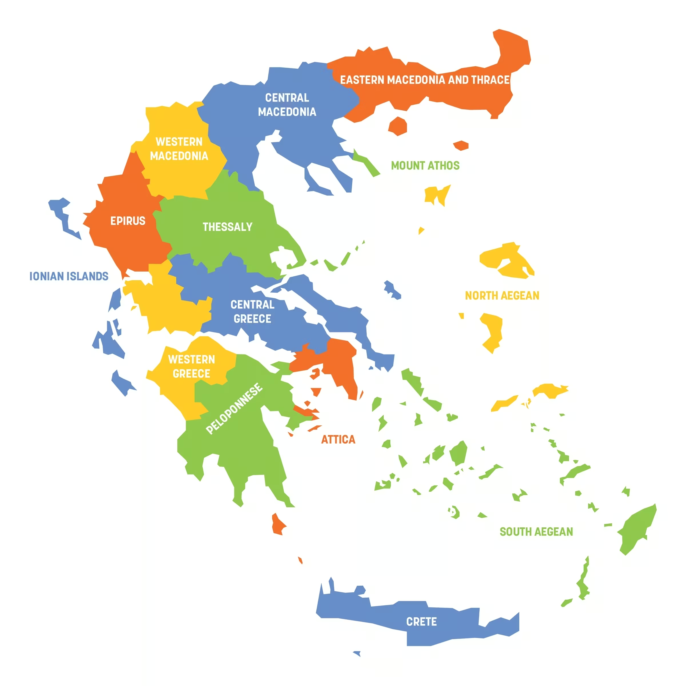
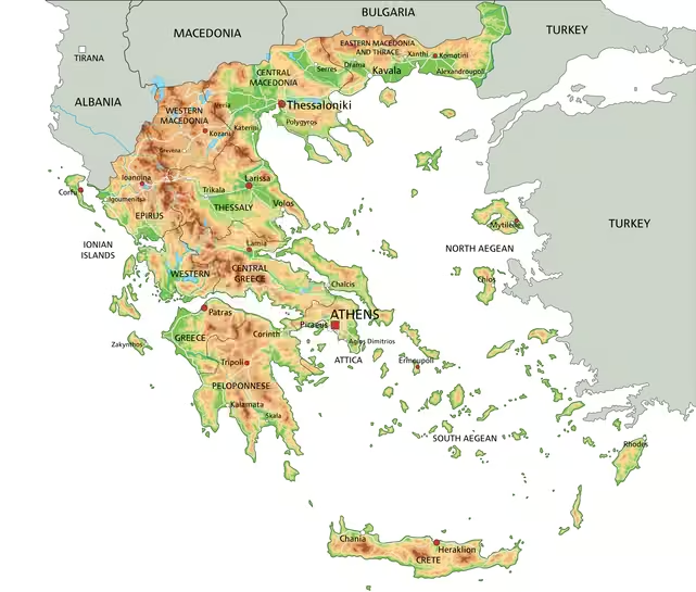
I didn’t fully understand it either until I saw a color coded Greek islands map that separated each region.
That was my lightbulb moment.
Oh. They’re grouped. They’re not scattered confetti.
Since then, I’ve flown into Santorini, taken high speed ferries through the Cyclades, nearly watched the wind steal my husband’s shirt off the top deck, spent two full weeks driving across Crete, and helped countless readers avoid trying to combine Corfu, Santorini, and Crete in one week.
I live in these logistics. The most common mistake I see when people send me draft routes isn’t hotel choice, it’s geography.
After island hopping across multiple regions, I realized the biggest mistakes people make come down to the map, not preference.
The most common mistake people send me isn’t hotel choice…it’s geography. Let me look at your route.
But first, you need to understand how the regions fit together.
Because once you understand the Greek island regions, you stop cramming opposite sides of the country into seven days and start planning like someone who actually knows the map.
This isn’t about which island is best for families or honeymooners. We’ll do that separately.
This is the structural blueprint.
Let’s open the map.
Short on time? Scroll to the region comparison chart to see which islands are closest to Athens.
How the Greek Island Regions Are Divided (Big Picture First)

The Greek island regions are divided by geography. Period.
Not by who has the prettiest sunset.
Not by which island went viral on TikTok. Not by “vibes.”
Geography.
And once you understand that, the chaos calms down immediately.
When I first started planning my own trips, I’d stare at a Greek islands map like it personally offended me.
Tiny islands everywhere. Clusters of dots. Zero sense of scale.
I felt like Greece had shaken glitter over the sea and said, “Have fun figuring that out.”
Then I saw a color coded version of the map.
Each region separated into its own color.
And I swear my brain went, “Ohhhhh. They live in neighborhoods.”
That was the moment everything clicked.
The Seven Major Greek Island Regions
Greece officially groups its islands into seven major regions:
• Cyclades
• Dodecanese
• Ionian Islands
• Sporades
• Saronic, also called Argosaronic
• North Aegean Islands
• Crete
They’re grouped by location and by the sea they sit in.
The Ionian Islands are in the Ionian Sea, which is west of mainland Greece.
Everything else, except Crete, sits in the Aegean Sea, which is east and southeast of mainland Greece.
That’s your first big mental shift.
West equals Ionian.
East equals Aegean.
Already simpler.
Then within the Aegean, islands are grouped based on how far north, south, or east they are.
Think of it like neighborhoods in a city.
You would not casually hop from one suburb to another across town without thinking about traffic.
Same idea here. Except traffic is a ferry schedule.
Now let’s talk about the outlier.
Crete.
Crete stands alone because it is huge.
It is not a “cute add on.”
It sits so far south that it’s less than 200 miles from North Africa.
Which, in American terms, feels like a Sunday drive. In Mediterranean terms, that’s dramatic.
It’s closer to Africa than most people realize.
And once you see that on a map, you understand immediately why it doesn’t casually pair with everything.
This is why understanding the Greek island groups first changes everything.
They’re not scattered randomly.
They’re clustered with intention.
And clusters are how you plan.
Quick Directional Compass
If maps make your brain short circuit, here’s the simplified version.
Picture mainland Greece in the center.
West = Ionian
Corfu, Kefalonia, Zakynthos. Different sea. Lush. Green. Separate world.
Southeast of Athens = Cyclades
Santorini. Mykonos. The white buildings everyone saves on Instagram.
Far southeast = Dodecanese
Closer to Turkey. Beautiful. But far. Logistics matter here.
Right off Athens = Saronic
Hydra. Aegina. Poros. Ferry ride, not expedition.
Northeast = Sporades & North Aegean
More remote. Fewer casual hops.
South. Way south. = Crete
Not a side quest. A full destination.
If you remember nothing else:
West equals Ionian.
Southeast equals Cyclades.
Far southeast equals Dodecanese.
Near Athens equals Saronic.
Northeast equals Sporades and North Aegean.
South equals Crete.
That’s your mental compass.
Why Understanding Regions Changes How You Plan

Here’s where this stops being geography class and starts being vacation sanity.
Geography determines logistics.
Logistics determine ferry time.
Ferry time determines whether you’re relaxed… or rage checking ferry schedules at midnight.
I cannot tell you how many times I’ve seen someone plan Corfu, Santorini, and Crete in one week.
On the surface, they’re all just “Greek islands.”
In reality? You’re zigzagging from the Ionian Sea to the Cyclades to the southern edge of the country.
That is not relaxing.
Same story with Zakynthos and Santorini. Opposite sides of Greece.
Entirely different seas. Entirely different transport systems.
And then there’s the classic assumption that every island has an airport.
They do not.
Or thinking a ferry is a quick little 45 minute hop when it’s actually four hours and two ports away.
Once people understand the Greek island regions, something shifts.
They stop trying to cram everything in.
They group islands logically.
They breathe.
They book smarter routes.
They feel empowered instead of overwhelmed.
This is why I always start here.
Before hotels. Before beaches.
Before arguing about which sunset is “the best.”
We talk geography.
Now we zoom into the most famous region first.
The Cyclades.
And yes, this is where the wind tried to steal my husband’s shirt.
Cyclades

If Greece had a main character energy region, it would be the Cyclades.
This is the white buildings. The blue domes.
The cliffs that make you question whether your camera is good enough.
The islands that launched a thousand Pinterest boards.
And yes, this was my first Greek island experience.
Where the Cyclades Are Located
The Cyclades sit in the Aegean Sea, southeast of Athens.
If you look at a Greek islands map, they form a loose cluster in the middle of the Aegean.
That cluster is the reason the Cyclades work so well for first-time Greek island hopping.
Short distances create flexibility.
From Athens, you’re heading southeast. Not west. Not north. Southeast.
And because they sit relatively close to one another, ferry routes between them are frequent and logical.
This is why the Cyclades are the region most people successfully island hop without wanting to cry in a port.
What the Cyclades Are Known For
The Cyclades are known for:
• Whitewashed cube shaped houses
• Blue domes and bright bougainvillea
• Dry, rocky landscapes, which means less shade than people expect in summer, so pack accordingly.
• Unreal cliffside views
• Wind that will test your hairstyle
This region feels bright and dramatic.
The landscape is more rugged and arid compared to somewhere like the Ionian Islands, which are lush and green.
Culturally, the Cyclades carry that iconic Greek postcard aesthetic.
You’ll see tiny chapels. Fishing boats bobbing in harbors.
Alleyways so pretty you accidentally take 17 photos of the same corner.
The travel atmosphere depends on the island.
Some are buzzy. Some are sleepy.
Some are polished. Some are barefoot simple.
But visually? They are unmistakable.
Major Islands in the Cyclades

Well known:
• Santorini
• Mykonos
• Naxos
• Paros
• Milos
Lesser known:
• Sifnos
• Serifos
• Folegandros
• Amorgos
• Andros
Santorini is cliffside dramatic. Naxos is flatter and more beach heavy. Mykonos leans nightlife. Paros balances both.
My first Cycladic island was Santorini, and we flew there.
And no, you do not see the caldera from the airport. You land. You grab your bag. You get in a car. And then at some point, you round a bend and suddenly the caldera appears and your brain just short circuits for a second.
Later, we paired Santorini with Mykonos on the same trip, and it worked beautifully.
Two islands. Same region.
Straightforward ferry connection. No cross country zigzagging.
That’s what staying within one island group does. It keeps your trip flowing instead of fracturing.
If you’re wondering how many islands fit into one itinerary without overdoing it, I break that down in my Greek island hopping guide.
It’s less about “how many can I squeeze in” and more about “how much do I want to move.”
How to Get to the Cyclades from Athens
Now we talk logistics. This is where things either feel smooth… or chaotic.
Ferry
Most ferries to the Cyclades leave from:
• Piraeus, the main port of Athens
• Rafina, which is often closer to the airport
Time ranges vary based on distance and ferry type.
As a general idea:
• Closer islands can be around 2 to 3 hours on a high speed ferry
• Farther routes can stretch 4 to 8 hours on conventional ferries
I book all my Greek ferry tickets through Ferryhopper. Schedules are current and you can compare routes in one place.
I almost always choose high speed ferries because I value time over romance.
I am not trying to spend half my vacation watching containers drift by.
That said, if you go up to the top deck in summer, the Meltemi winds will absolutely try to humble you.
My husband nearly donated a shirt to the Aegean once.

It was one strong gust away from becoming a maritime offering.
Wind is part of the Cyclades experience.
Ferry cancellations due to wind do happen in peak summer.
It’s one of the reasons I always travel with insurance that covers trip interruptions. I use Seven Corners and the coverage is flexible and the price is reasonable for what you get
Ferry frequency is high in summer. In shoulder season, routes thin out.
This matters when you’re sequencing islands.
And if you’ve ever stared at ferry schedules and felt your blood pressure rise, you are not alone.
Once you understand how routes cluster within regions, it becomes much easier to map things out logically.
Flight
Several Cycladic islands have airports:
• Santorini
• Mykonos
• Naxos
• Paros
• Milos
Flights from Athens are usually around 40 to 50 minutes in the air.
Flights make sense when:
• You’re short on time
• You’re heading to one of the farther islands
• Ferry schedules don’t align with your arrival
This is purely distance based strategy. Not personality based. Not “am I adventurous enough for a ferry.”
Sometimes the smart move is just getting there quickly.
Logistics Notes People Don’t Expect
Wind. Let’s start there.
The Meltemi winds are strong in summer. Not dangerous. Just aggressive.
Outdoor dinners? Secure your napkins. Ferry decks? Hold your belongings like they owe you money.
The Cyclades also have excellent route clustering.
Islands sit relatively close together compared to other Greek island regions.
That’s what makes hopping Santorini to Paros to Naxos feel natural.
This is very different from trying to combine islands on opposite sides of Greece, which is where planning stress creeps in fast.
The biggest surprise for most people?
How easy island hopping can feel when you stay inside one region.
And how chaotic it feels when you don’t.
If you’re already mentally plotting which Cycladic islands to combine, that’s exactly the question I look at inside the itinerary review. Sequencing within the Cyclades sounds simple until ferry timing gets involved.
↑ Back to All Greek Island Regions
Dodecanese

If the Cyclades are clustered and central, the Dodecanese are stretched farther east, closer to Turkey.
These islands feel a little more tucked away. A little more “you meant to come here.”
And geography really matters here.
Where the Dodecanese Are Located
The Dodecanese sit in the southeastern Aegean Sea, near the Turkish coast.
From Athens, you’re heading far southeast. Not a casual little hop. A real distance.
On a Greek islands map, you’ll see them scattered along the eastern edge of the country.
They’re not tightly packed like the Cyclades. They stretch vertically down the coast.
That distance shifts how you approach the region.
Longer ferries. Fewer quick pivots.
More deliberate sequencing.
It’s the kind of place you build time around, not squeeze between stops.
What the Dodecanese Are Known For
The Dodecanese are known for:
• Medieval architecture and castle towns
• Strong Italian influence in some islands
• Warmer climate due to southern location, which means shoulder season here can feel more like peak summer elsewhere.
• A slightly less “white cube postcard” aesthetic
Visually, this region can feel more layered historically.
Stone walls. Fortifications. Old towns that look like they’ve seen things.
The atmosphere varies island to island, but overall it tends to feel a little less chaotic than peak Cycladic hotspots.
Less “look at me.”
More “come wander.”
Major Islands in the Dodecanese
Well known:
• Rhodes
• Kos
• Patmos
• Karpathos
Lesser known:
• Kalymnos
• Symi
• Leros
• Astypalea
You’ll notice these aren’t usually the islands people try to combine casually with Santorini.
And when they do, that’s when I gently pull up the map and say, “Let’s talk.”
How to Get to the Dodecanese from Athens

Here’s where strategy matters.
Ferry
Ferries do run from Athens, typically from Piraeus.
But because of the distance, travel times can be long.
Athens to Rhodes by ferry can easily run 12+ hours depending on route.
Sometimes overnight routes. Sometimes multi stop routes.
This is not a quick two hour glide across the water.
If you’re already mapping out a multi island trip, this is where staying within one region starts to make sense.
Crossing from the Cyclades to the Dodecanese mid trip?
It can be done. But it’s not always the smoothest move.
When you’re sequencing islands, this is exactly why I always say start with geography first before locking anything in.
Flight
Several Dodecanese islands have airports, including:
• Rhodes
• Kos
• Karpathos
Flights from Athens are typically around one hour to a little over an hour.
Because of the distance, flights often make more sense here than ferries if you’re short on time.
This is one of those regions where distance based decisions matter more than romantic ferry dreams.
For help figuring out the right trip length to keep things relaxed, see my post on how many days in Greece is actually enough.
Distance adds up quickly.
Logistics Notes People Don’t Expect
Distance defines this region more than anything else.
It shapes the ferry routes, the pacing, and the type of trip it naturally supports.
The Dodecanese are simply farther from Athens than the Cyclades or Saronic Islands.
That means longer ferry durations.
Fewer quick hops. More intention required.
Ferry frequency between islands within the Dodecanese can be decent in summer, but not as dense or rapid as the Cyclades cluster.
And because this region stretches along the eastern edge of the country, combining it with western regions like the Ionian Islands adds real travel layers.
It’s not impossible.
It just requires more time than most people assume.
Which brings us to the Ionian Islands.
And this is where the water gets warmer than you expect.
When distance enters the equation like this, pacing becomes more important than preference.
↑ Back to All Greek Island Regions
Ionian Islands
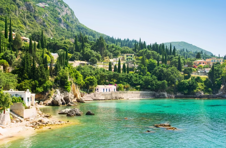
The Ionian Islands sit on the west side of Greece, in the Ionian Sea.
Which means the second you start looking at a map, you realize something important.
They are separated from the Cyclades and the rest of the Aegean by the entire Greek mainland.
That’s not a small detail.
Where the Ionian Islands Are Located
From Athens, you’re heading west across the mainland before you even think about stepping on a boat.
On a map, the Ionian Islands stretch down the western coastline.
Corfu in the north. Zakynthos and Kefalonia farther south.
Lefkada hugging the mainland closely enough that you can actually drive onto it via bridge.
Geographically, they function almost like their own lane of Greece.
That separation shapes everything about how you reach them and how you combine them with other regions.
What the Ionian Islands Are Known For
The first thing that surprised me about the Ionian was the color.
After time in the Cyclades, where the landscape is dry and sun baked, the Ionian feels almost lush.
Hills covered in green. Forested cliffs dropping into impossibly blue water.
It feels cinematic.
And the water?
Warmer than you’d expect, even though many of these islands sit farther north than Santorini or Mykonos.
The Ionian Sea behaves differently than the Aegean.
Less exposed to the same wind patterns. Deeper in places. Different currents.
You feel it when you swim.
Architecturally, you’ll notice Venetian influence in places like Corfu.
The history reads differently here.
The streets feel different under your feet.
The overall travel atmosphere leans relaxed.
Space. Scenic drives. Long viewpoints.
It invites you to explore by car in a way some of the smaller Cycladic islands don’t.
Major Islands in the Ionian

Well known:
• Corfu
• Kefalonia
• Zakynthos
• Lefkada
Lesser known:
• Ithaca
• Paxos
• Antipaxos
This is where I see planning start to wobble.
Zakynthos paired with Santorini sounds dreamy on a Pinterest board.
On a map, you’re crossing the entire country.
Different seas. Different port systems. Different transport chains.
Once you see the regions clearly, you stop building trips based on island names alone and start thinking in geographic clusters.
That shift alone removes so much stress.
How to Get to the Ionian Islands from Athens

Getting to the Ionian requires an extra step compared to most Aegean islands.
Ferry
There is no direct ferry from Athens to Corfu, Kefalonia, or Zakynthos.
Instead, you travel to a mainland port on the west coast, usually by car or bus.
Ferry connections to the Ionian require more planning than the Aegean routes.
I use Ferryhopper to check what’s actually running and when, especially before committing to a sequence.
Ports like Igoumenitsa or Kyllini serve as departure points.
From there, you board your ferry.
It’s a layered journey. Very doable.
Just different from rolling up to Piraeus and hopping straight onto a boat bound for Paros.
That difference becomes important when you’re deciding whether to mix regions on a short trip.
Flight
Several Ionian islands have airports:
• Corfu
• Kefalonia
• Zakynthos
Flights from Athens take roughly an hour.
Because of the mainland separation, flying often simplifies things significantly, especially if you’re starting or ending your trip in this region.
When people feel overwhelmed trying to combine west and east in one itinerary, it usually comes down to underestimating this repositioning step.
Once you factor that in early, decisions get clearer.
Logistics Notes People Don’t Expect
The mainland transfer surprises people the most.
Greek island hopping looks seamless on Instagram.
In reality, each region operates within its own transportation rhythm.
The Ionian has its own pattern. The Cyclades have theirs.
Hopping within the Ionian can be smooth when islands share mainland ports.
Crossing from the Ionian to the Cyclades? That’s a bigger pivot.
It often involves a flight or a long transit day.
None of this is dramatic.
It just requires awareness.
And awareness is what turns a stressful itinerary into a smart one.
This is exactly the kind of region pairing where I see itineraries start to unravel — not because the islands are wrong, but because the sequencing is.
If You’re Mentally Rearranging Your Trip Right Now
This is usually the point where people pause and realize their original island combination might not flow the way they imagined.
That’s completely normal.
Most itinerary issues aren’t about picking the wrong Greek islands.
They’re about sequencing islands that sit in different logistical lanes.
If you’re reading this and quietly rethinking your route, that’s the right instinct. It’s always easier to adjust the sequence than to fight it on the ground.
Sometimes it’s a small tweak.
Sometimes it’s a full reshuffle.
But either way, it’s far easier to adjust before ferry tickets and hotels are locked in.
Now, let’s keep going.
↑ Back to All Greek Island Regions
Sporades
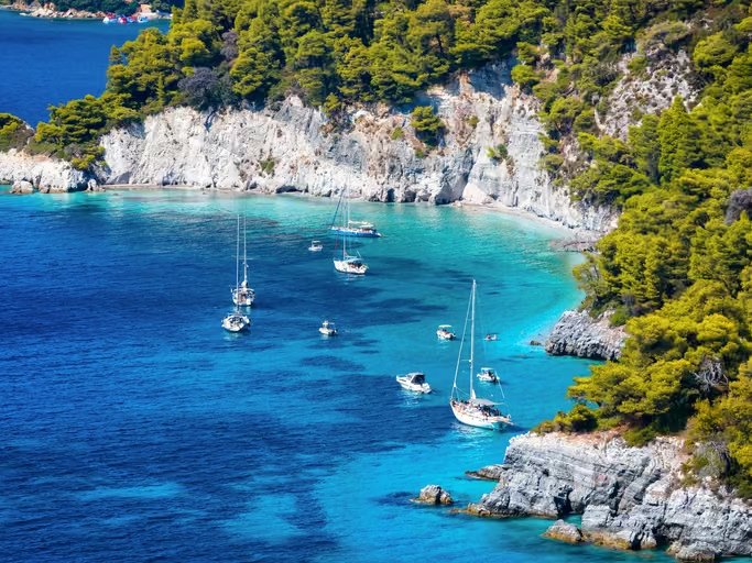
The Sporades are what Greece looks like when it swaps white cliffs for pine trees.
They sit in the northwestern Aegean Sea, northeast of Athens, and they feel different immediately.
Greener. Softer. Less windswept drama. More forest meets water calm.
But their geography does something else, too.
It quietly slows you down.
Where the Sporades Are Located
From Athens, you’re heading northeast.
First to a mainland port like Volos or Agios Konstantinos, then onto a ferry.
Volos, for example, is roughly a four-hour drive from Athens.
That’s not extreme.
But it’s not “roll up to Piraeus and board in 20 minutes” either.
That extra mainland step shifts the energy. These islands aren’t built for impulsive hopping.
They’re built for intention.
On a Greek islands map, the Sporades form a small green cluster off the eastern mainland.
Not central like the Cyclades.
Not stretched like the Dodecanese.
And because they sit outside the main ferry superhighways, the transportation rhythm is calmer. Routes exist, they’re just not constant.
Which shapes how you plan.
What Makes the Sporades Different
The Sporades are known for:
• Pine forests that roll straight into turquoise water
• Soft sandy beaches that feel very different from the rockier Cycladic shores
• A relaxed, local atmosphere
• Fewer high-frequency ferry routes
Major islands:
• Skiathos
• Skopelos
• Alonissos
If Skopelos looks familiar, it might be because parts of Mamma Mia were filmed here.
That dramatic white chapel perched above electric blue water? Very real. Very Sporades.
But here’s the thing.
The movie gave the region a visual spotlight.
It didn’t turn it into Santorini 2.0.
These islands still feel grounded.
They don’t revolve around a single caldera viewpoint or one iconic harbor.
They invite you to explore slowly.
To drive winding roads through pine forests.
To find beaches that feel tucked away rather than staged.
It’s Greece without the sharp white minimalism of the Cyclades.
The colors are deeper. The greens are richer. The atmosphere is softer.
And because ferry connections aren’t stacked every hour like they are in the Cyclades, most travelers naturally spend longer on one island instead of bouncing between three.
Two islands in a week here? Great.
Three? Usually unnecessary.
This region rewards staying put.
How to Get to the Sporades from Athens

Ferry
Most ferry routes depart from mainland ports after that drive or bus ride north.
Travel times vary, but what’s important is density.
Unlike the Cyclades, you won’t find high-speed ferries departing every hour in peak season.
There are connections between Skiathos, Skopelos, and Alonissos.
They just require more sequencing awareness.
If you miss one, you’re not hopping on the next one 45 minutes later.
That alone shifts how aggressively you plan your island movements.
Flight
Skiathos has an airport with short flights from Athens, around 40 minutes in the air.
Skopelos and Alonissos do not have airports. You reach them by ferry from Skiathos or the mainland.
Flying can simplify things dramatically, especially if you want to skip the mainland transfer altogether.
For shorter trips, this is usually the smarter move.
Logistics Notes People Don’t Expect
The Sporades feel quieter because they are quieter.
Not remote in an inaccessible way. Just slightly outside the main tourist rhythm.
Fewer ferry departures mean fewer spontaneous pivots.
That encourages longer stays on one island rather than constant movement.
This is not the region people string into three-island sprints with military precision.
It’s the region you choose when you want to unpack a little.
When you don’t mind renting a car.
When you’re happy driving forested roads down to hidden beaches.
And honestly?
That slower rhythm is the entire point.
The Sporades reward travelers who want to settle in rather than sprint through.
↑ Back to All Greek Island Regions
Saronic Islands
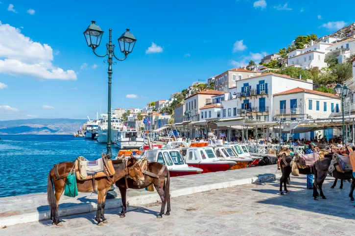
The Saronic Islands are the islands you go to when you want to feel like you left Athens… without actually committing to leaving Athens.
They sit in the Saronic Gulf, just off the capital’s coastline.
Close enough that you can watch the mainland fade behind you.
Far enough that your nervous system immediately unclenches.
And that proximity?
That’s their superpower.
Where the Saronic Islands Are Located
From Athens, you head to Piraeus port.
You board a ferry.
And in under an hour to two hours — depending on the island — you’re stepping onto cobblestone instead of concrete.
On a Greek islands map, they’re practically hugging the mainland.
They’re not floating out in the middle of the Aegean like the Cyclades.
They’re right there. Waiting.
That geography makes them the easiest island region to access from Athens.
No airport decisions.
No half-day sea crossings.
No multi-port chess moves.
One short stretch of water, and suddenly you’re on an island.
What Makes the Saronic Islands Different
The Saronic Islands are known for:
• Being the closest islands to Athens
• Frequent, short ferry routes
• Car-free charm on certain islands
• Weekend escape energy
Major islands:
• Hydra
• Aegina
• Poros
• Spetses
Hydra is the one everyone whispers about.
No cars. None. You walk. You climb.
You watch donkeys casually carry luggage uphill like they’ve seen it all before.
When you step off the ferry in Hydra, it genuinely feels like someone hit pause on Athens.
The harbor curves inward like a protective bowl.
Stone mansions rise behind it. Boats bob. People linger.
No honking.
No traffic lights.
No scooters weaving around you.
Just sea air and the clink of glasses at waterfront tavernas.
It’s not towering cliffs and white cube villages like the Cyclades.
It’s something softer. More intimate. More lived in.
The Saronic Islands feel like Greece’s quiet flex.
Close to the capital. Easy to reach. Still wildly charming.
And they’re perfect as a 1–2 night buffer before or after your Athens stay.
Long enough to breathe. Short enough to stay flexible.
How to Get to the Saronic Islands from Athens

Ferry
Depart from Piraeus.
Travel times are short:
• Aegina can be as quick as 40 minutes
• Hydra usually around 1 to 1.5 hours
• Spetses closer to 2 hours
Hydrofoils and conventional ferries run frequently, especially in warmer months.
You can day trip.
You can overnight.
You can pivot if your Athens plans change..
That flexibility is rare in other Greek island regions.
If you want island atmosphere without committing to full island-hopping logistics, this is where you do it.
Flight
There are no commercial flights.
And honestly?
The whole point here is that you don’t need one.
Logistics Notes People Don’t Expect
Because they’re so close, people sometimes underestimate them.
They assume proximity equals less impressive.
That’s a mistake.
The Saronic Islands are not about remoteness. They’re about contrast.
The shock of going from Athenian energy to harbor calm in under two hours is powerful.
It makes them ideal if you’re figuring out how many days to spend in Athens before heading deeper into the islands.
Or if you want to ease into your trip without diving straight into complex ferry routes.
They also don’t lend themselves to aggressive island hopping the way the Cyclades do.
These islands are about ease. About pairing. About balance.
Hydra’s no-cars rule?
Incredibly charming.
Until you’re dragging a suitcase uphill.
Still charming.
↑ Back to All Greek Island Regions
North Aegean Islands
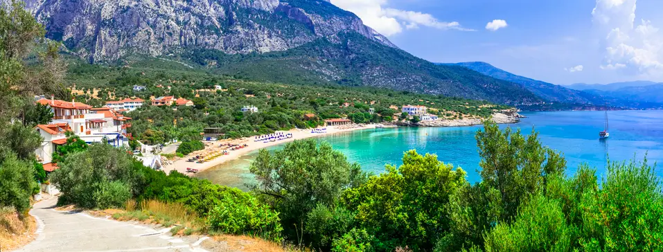
The North Aegean Islands are the ones people forget about.
Not because they’re not beautiful.
But because they’re far.
And distance has a way of filtering casual planners.
These islands sit in the northeastern Aegean Sea, closer to Turkey than to Athens.
When you see them on a Greek islands map, they’re not clustered conveniently near the middle.
They’re out there.
Slightly removed.
A little independent.
Intentionally so.
And that geography shapes the entire experience.
Where the North Aegean Islands Are Located
From Athens, you’re heading northeast across open Aegean water.
Not two hours southeast like Paros.
Not a quick Saronic hop.
This is a real stretch of sea.
Ferries from Piraeus can run long.
Often overnight. Sometimes 9 to 12 hours or more depending on the island and route.
When you see those numbers for the first time, you understand immediately why these islands don’t get casually added to a “Santorini and maybe one more?” itinerary.
They require intention.
And unlike the Dodecanese, which stretch vertically along the southeastern edge of Greece and can sometimes be sequenced in a chain, the North Aegean islands feel more spread out and less designed for tight, efficient hopping.
This is not a region built for loops.
It’s built for depth.
What Makes the North Aegean Different
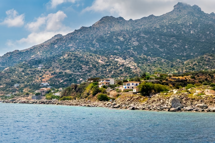
The North Aegean Islands are known for:
• Larger landmass on several islands
• Deep cultural roots and regional specialties
• Fewer international crowds
• Long ferry routes
Major islands:
• Lesvos
• Chios
• Samos
• Ikaria
• Limnos
These islands feel more lived in.
Less polished for visitors.
More integrated into everyday Greek life.
Chios is known for mastic. Lesvos for ouzo. Ikaria for its famously slow pace of life and long-lived residents.
These aren’t marketing taglines.
They’re regional identities that have existed for centuries.
Architecturally and culturally, you’ll feel a blend of influences shaped by proximity to Asia Minor.
Stone villages. Working ports. Daily life that doesn’t revolve around cruise ship schedules.
This is Greece without the performance.
It’s layered.
It’s real.
It’s not trying to impress you.
And because ferry frequency between islands is more limited and distances are greater, most travelers who choose the North Aegean stay put.
Four to seven days on one island isn’t excessive here.
It’s normal.
How to Get to the North Aegean from Athens
Ferry
Ferries depart from Piraeus.
Travel times can range around 9 to 12 hours or longer depending on the island and stops. Many routes are overnight.
This isn’t a casual afternoon crossing.
It’s a travel day you plan around.
It’s doable. Just not casual.
Flight
Several North Aegean islands have airports, including Lesvos, Chios, Samos, Ikaria, and Limnos.
Flights from Athens typically take around 50 to 60 minutes.
For most travelers with limited time, flying is the practical choice here.
And this is where that broader “how far are Greek islands from Athens?” question stops being theoretical and becomes very real.
Distance is no longer abstract when you’re staring at a 10-hour ferry listing.
Logistics Notes People Don’t Expect
The North Aegean doesn’t operate like the Cyclades.
You’re not hopping between five islands in a tight loop.
Ferry frequency between islands is more limited and often seasonal.
Distances are greater. Routes require more forethought.
That’s not a drawback.
It’s a filter.
People who choose the North Aegean usually want depth over density.
Fewer moves. Longer stays. More immersion.
It’s a region for settling in.
For learning a place rather than collecting it.
And that’s a very different trip than bouncing between Paros and Mykonos every two days.
↑ Back to All Greek Island Regions
Crete
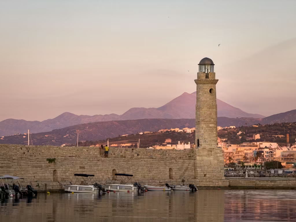
Crete is its own universe.
It is the largest of all the Greek island regions.
It stretches so wide east to west that driving across it feels less like island hopping and more like crossing a small country.
And geographically?
It anchors the southern edge of Greece, with the Libyan Sea stretching below its southern coast.
It sits so far south that it’s less than 200 miles from North Africa.
When I first realized that, it stopped feeling like “just another island” and started feeling like something entirely different.
Because it is.
Where Crete Is Located
Crete sits directly south of mainland Greece, forming a long horizontal bar at the bottom of the map.
From Athens, you’re heading straight south across open sea.
That distance matters.
Ferries from Piraeus typically run overnight and take roughly 6.5 to 9 hours depending on route and port.
Flights take under an hour.
And I’ll be honest.
I respect overnight ferries. I understand the romance of them.
But when I can be in Crete in 55 minutes by plane, I’m choosing the plane.
That decision alone changes how you structure your itinerary.
Crete is not a “while we’re there” island.
It requires its own time block.
If you have fewer than 4–5 days, focus on one region of Crete — not the entire island.
Trying to “see Crete” in two days is like trying to “see Italy” from a train window.
What Makes Crete Different
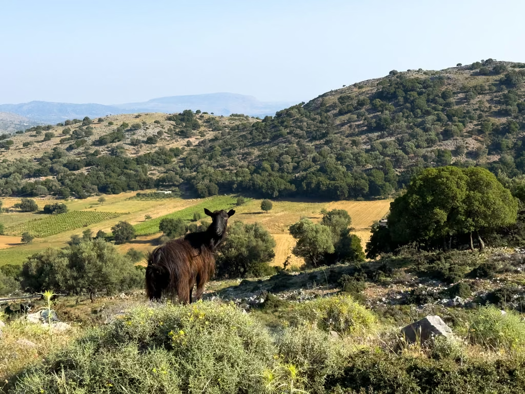
Crete is known for:
• Massive scale
• Distinct personalities between west and east
• Some of the best beaches in Greece
• Deep history layered into everyday life
• Mountain ranges that cut dramatically across the island
Major cities and regions:
• Chania
• Rethymno
• Heraklion
• Lasithi
We spent one full week in the Chania region and another full week in the Rethymno region.
Two weeks.
And we still didn’t feel “done.”
Driving in Crete is not like hopping between Paros and Naxos.
You’re covering real distances.
Mountain roads. Coastal highways.
Tiny villages that appear out of nowhere.
You don’t casually “pop over” to the south coast.
You plan for it.
Mountain passes shift the weather.
The north coast feels different from the south.
Chania feels different from Heraklion.
It’s not one island experience.
It’s multiple.
And then there are the beaches.
Crete beaches are in a different category.
Wide. Wild. Sometimes pink sand.
Sometimes backed by cliffs.
Sometimes framed by mountains.

Some of the best beaches in Greece I’ve experienced have been here.
Sfakia on the south coast of Crete feels like you’ve reached the edge of something. It’s raw. Rugged. Far from everything in the best possible way.
And then there are the people.
We stayed in neighborhoods where locals actually live.
Not resort zones.
Not cruise port zones.
A Yia Yia walked down our alley every day. We waved. We chatted. We became part of the rhythm.
That’s Crete.
Nothing here feels staged.
You adapt to Crete’s rhythm, not the other way around.
How to Get to Crete from Athens
Ferry
Overnight ferries depart from Piraeus to ports like Heraklion and Chania.
Travel time is typically between 6.5 and 9 hours depending on vessel and route.
Cabins are available. Some people love the overnight ferry experience.
You sleep. You wake up on an island.
With two main ports and overnight routes in the mix, Crete ferry logistics are worth checking early.
Ferryhopper shows current schedules and lets you compare routes before anything is locked in.”
If you enjoy sea travel and want to maximize daytime hours, it can work beautifully.
I personally prefer flying.
Flight
Flights from Athens to Heraklion or Chania are typically around 50 to 55 minutes in the air.
Because of Crete’s size and distance from Athens, flying is often the most practical choice for shorter trips.
If you’re combining Crete with another region, this is where strategy really matters.
Pairing Crete with nearby Cycladic islands can work with careful sequencing.
Pairing it with the Ionian on a tight itinerary?
That’s when geography starts pushing back.
Crete demands space.
Logistics Notes People Don’t Expect
Crete’s size is what catches most people off guard.
It doesn’t behave like the other islands.
People treat it like Naxos.
It is not Naxos.
Driving across Crete can take 5-6 hours.
If renting a car, I compare rental options through DiscoverCars. It pulls both big brands and local agencies so you’re not overpaying for the same car.
The south coast alone can feel like its own world.
Weather patterns move as you cross mountain ranges.
You cannot “see Crete” in 48 hours.
When someone tells me they want to do Crete in two days, my internal calculator just quietly shuts down.
Crete rewards slowing down.
Long dinners. Fewer daily stops.
Time to wander a village without checking your watch.
It changed my pace completely. It softened it.
And if you’re comparing Crete vs other Greek islands, the difference is scale and depth.
Smaller islands feel concentrated.
Crete feels expansive.
It could be its own country and no one would argue.
Crete doesn’t fit neatly into the same mental box as the other Greek island regions.
It anchors the map.
And once you see that clearly, you stop trying to squeeze it in and start giving it the space it deserves.
Crete is one of the most common islands people underestimate when they send me draft itineraries.
↑ Back to All Greek Island Regions
Comparing All Greek Island Regions by Athens Access

If you just want the quick answer to “How far are the Greek islands from Athens?” this is your scroll-friendly cheat sheet.
No charts. No eye strain. Just clarity
Closest to Athens
Saronic Islands
• Ferry from Piraeus
• 40 minutes to 2 hours
• No flights
• Ideal for day trips or short overnights
These are your easiest islands. Minimal commitment. Maximum contrast.
Moderate Distance, Strong Ferry Network
Cyclades
• Ferry from Piraeus, Rafina, or Lavrio
• Roughly 2.5 to 8 hours depending on island and ferry type
• Flights about 40 to 50 minutes to major islands
• Dense ferry routes between islands
This region is the most flexible for island hopping. The cluster works in your favor.
If you’re still mapping out how many Greek islands you can realistically combine, this is usually where it starts to make sense.
Far Southeast, Longer Commitment
Dodecanese
• Ferry from Piraeus
• Often 13+ hours depending on island
• Flights around 1 hour
• Inter-island ferries exist but distances are real
This is not a casual add-on region. It rewards dedicated time.
West of Mainland, Extra Step Required
Ionian Islands
• No direct ferry from Athens
• Travel overland to western ports first
• Flights around 1 hour
• Limited direct ferry connections between regions
The mainland transfer is the game changer here.
If you’re wondering whether you can combine Ionian and Cyclades easily, the short answer is: only with strategy and enough days.
Northeast, More Remote
Sporades
• Travel to mainland port first
• Ferry about 1 to 3 hours after that
• Skiathos has a short flight from Athens
• Fewer ferry departures
This region naturally encourages fewer moves.
Far Northeast, Long Routes
North Aegean
• Ferry from Piraeus
• Often 9 to 12+ hours
• Flights around 50 to 60 minutes
• Inter-island routes are more limited
Distance is the defining feature here.
Way South
Crete
• Overnight ferry about 6.5 to 9 hours
• Flights about 50 to 55 minutes
• Multiple airports
• Massive island once you land
Crete isn’t just far. It’s big.
And that’s two separate planning considerations.
What This Actually Means for Your Itinerary
Here’s the pattern:
Close islands give you flexibility.
Clustered islands give you flow.
Far islands require commitment.
Separated islands require repositioning.
Once you understand that, planning gets calmer.
You stop asking, “Can I see all of these?”
And start asking, “Which cluster makes sense together?”
If ferry logistics still feel overwhelming at this point, that’s completely normal.
It usually just means you haven’t looked at routes with geography in mind yet.
Now, before you finalize anything, read this.
↑ Back to All Greek Island Regions
The Most Common Greek Island Geography Mistakes
If you take nothing else from this guide, take this:
Most Greek island planning stress is geography stress.
It’s rarely about hotels or restaurants.
It’s rarely about packing lists.
It’s about the map.
Here are the mistakes I see over and over again.
Thinking All Greek Islands Are Close Together
On a zoomed out map, everything looks compact.
Tiny country. Tiny islands. How far apart could they be?
Far.
Some islands are a quick 45 minute ferry from Athens.
Others are 10 to 13 hours away by boat.
Crete sits way down south. The Ionian Islands sit on the opposite side of the mainland.
The North Aegean stretches up and out.
They are not clustered in one neat swimming pool.
They are spread across two seas.
Once you understand that, your expectations shift immediately.
Trying to Combine the Ionian and Cyclades Without Realizing the Distance
This one happens constantly.
Corfu and Santorini.
Zakynthos and Mykonos.
It sounds dreamy.
It is geographically aggressive.
You’re crossing the entire country. Different seas. Different ferry systems. Often a mainland transfer in between.
Can it be done?
Yes.
Should it be done on a 7 to 10 day trip?
Usually not.
This is where understanding the Greek island regions upfront saves you from a lot of mid-trip frustration.
If you’re still in the early stages of planning and trying to decide which islands make sense together, that’s exactly why starting with your overall framework for how to plan a trip to Greece matters more than picking islands off Instagram.
Assuming Every Island Has an Airport
They don’t.
Some major islands have airports. Many smaller ones do not.
That means you may:
• Fly into one island
• Ferry to another
• Return to a different port
If you don’t factor that in early, you end up building an itinerary that looks smooth on paper and complicated in reality.
And no one wants to discover that after hotels are booked.
Underestimating Ferry Duration
This is the quiet killer.
A ferry that says 6 hours is 6 hours.
Not 45 minutes.
Not “it’ll fly by.”
Six.
If you stack multiple long ferry days back to back, you start losing the relaxed rhythm that makes Greece magical in the first place.
Ferries are wonderful. I love them. I’ve taken plenty.
But they are part of your vacation time.
And if you’re trying to figure out how many Greek islands you should visit, ferry duration needs to be part of that conversation.
Treating Crete Like a Small Island
An example route from east to west in Crete
I’m calling this one out separately.
Crete is not Naxos.
It is not Paros.
It is not something you “see quickly.”
It’s enormous.
Driving from Chania to the south coast takes time. Exploring multiple regions requires planning. Two weeks there still felt full.
When someone tries to squeeze Crete into two days alongside Santorini and another island, that’s when geography gently taps you on the shoulder and says, “No.”
What Happens When You Get Geography Right
This is the part I love.
When someone understands the map first:
They stop cramming.
They stop zigzagging across the country.
They group islands logically.
They build in breathing room.
They relax.
They feel confident booking ferries instead of panicked.
And that’s the whole goal.
Not to see the most islands.
To experience them well.
If any of those mistakes sounded familiar, you’re not a bad planner. You just haven’t looked at the map yet. Greece geography just doesn’t announce itself. Send me your itinerary and I’ll show you where the map is working against you.
Does Your Island Order Actually Work?
Most Greece itineraries look fine on paper.
Then day three hits: a 6am ferry, a two-hour layover on the wrong island, and a half-day lost to backtracking.
The map was never on your side.
That’s what I catch before you leave.
Send me your itinerary and I’ll look at your sequencing, ferry days, airport logic, pacing, and buffer time and show you exactly where the geography is working for you and where it’s quietly working against you.
Sometimes it’s one swap. Sometimes it’s just a reorder.
Either way, you stop guessing and start packing.
Already know you want a route built from scratch? Custom itinerary planning is opening soon.
Why Understanding Greek Island Regions Comes Before Choosing an Island

Most people start with island names.
Santorini.
Mykonos.
Crete.
Corfu.
But the smarter move?
Start with the map.
When you understand the Greek island regions first, planning starts to feel simple.
Instead of crisscrossing the country, you begin clustering.
Instead of squeezing opposite coasts into one week, you narrow your focus.
Instead of forcing Crete into a quick stop, you give it the time it requires.
Planning shifts from reactive to intentional.
You start choosing within a cluster.
And once you’re choosing within a cluster, you’re no longer building a relay race.
You’re building a trip that flows.
Geography first.
Then island personality.
That order changes everything.
Now You Know the Map
If you came here wondering what the Greek island regions are and how they actually work, here’s the real answer:
They’re organized by geography.
Different seas.
Different clusters.
Different distances from Athens.
And those distances shape everything.
The overwhelm usually doesn’t come from having too many islands to choose from.
It comes from not understanding how they’re positioned.
Once you see the map clearly, the planning shifts.
When geography comes first, the route stops fighting you.
You start building clusters.
You stop squeezing in names.
You start thinking in flow.
Greece isn’t complicated.
It’s layered.
And when the layers make sense, planning feels intentional instead of chaotic.
From here, you have two options.
f you already have islands in mind but that quiet “does this actually work on the map” feeling won’t go away, that’s exactly what my itinerary review service is for.
I look at your sequencing, your pacing, and your ferry days and find where the geography is working against you before you get there.
If you’re still in the early dreaming stage, grab my free Greece starter guide.
It walks you through the foundational pieces most travelers skip so you avoid expensive, exhausting mistakes before you even book.
The goal isn’t to see the most islands.
It’s to experience them well.
And now?
You know how the map works.
More Greece Travel Tips
- Greek Island Hopping Itineraries for 7, 10, and 14 Days
- How to Choose Which Greek Islands to Visit (Without Regret)
- How Greek Island Regions Actually Work (And Why It Changes Your Itinerary)
- How to Plan a Trip to Greece Without Losing Your Mind
- How to Plan a Santorini Trip Without Losing Your Mind
- Mykonos vs Santorini: Which Island Is Better for You?
- 30 Things to Know Before Going to Greece